Tuesday 29 July 2008
Surprisingly, we had a little rain during the night. It was just enough to wet the Earthroamer and our camp chairs, which we had put outside so we could sit in front of the warm fire and look up at the Milky Way and the Southern Cross.
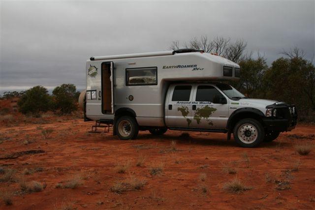
We were on the road at 7.55 am. The GPS said it was 607 kilometres (line of sight) to the border.
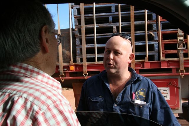
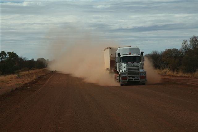
After driving for a short time we saw a huge road train stopped. The driver said that he came to Warburton from Perth once every two weeks. He could sit on about 80 kph on the good parts, and 60 kph on the bad bits. He was re-checking his load, which had moved slightly.
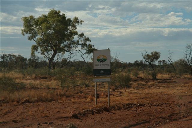
Every now and then on the road there would be a sign saying “Roads to Recovery.” We are not quite sure what they mean. Was it recovery from a recession at some time? We must find out.
(Later we researched Roads to Recovery. It was an initiative of the Federal Government from February 2001 to June 2005 to fund $1.2 billion for local road maintenance and upgrading. A further $1.2 billion was allocated over four years from July 2005 to June 2009).
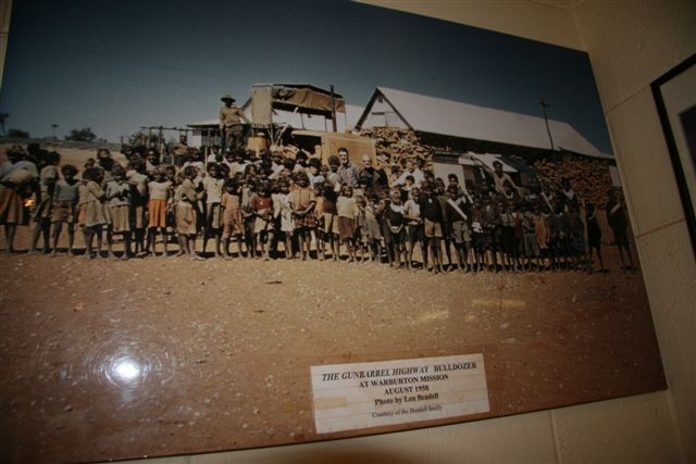
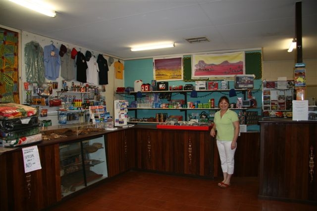
At 9.30 am we stopped at the Tjukayirla Roadhouse. Inside was a photograph of Len Beadell’s bulldozer, which Dick now has at our Gundaroo farm. It showed all the kids at Warburton standing around the bulldozer, and it was taken in August 1958 – obviously at the time when the Gunbarrel and the other highways were being built by Len.
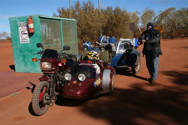
There were two couples with motorcycles and sidecars at the Roadhouse. What an adventure! They were riding from Fremantle to Borroloola. Have a look at that on a map. It is quite a way on little motor bikes with sidecars. In fact, the outfits seemed to be vintage – i.e. not the modern Hondas and BMWs you often see.
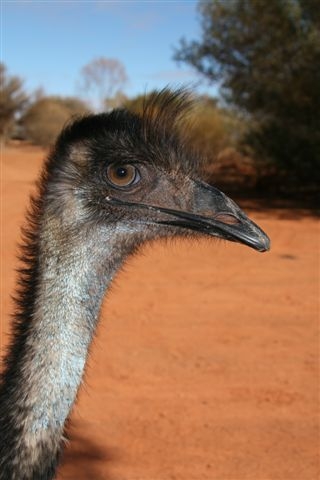
It is rather sad in a way that there were no Aborigines serving behind the counter. However the staff that served – Carol and Vicky, and Sussan Bignall and her husband Andrew – operate the Roadhouse under contract to the Blackstone Aboriginal community. The Roadhouse was immaculately clean, and out the back were two tame emus. We spent some time taking photographs and giving them a cuddle.


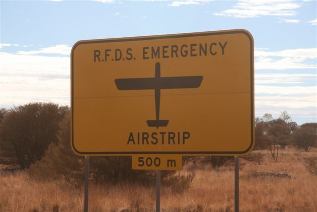
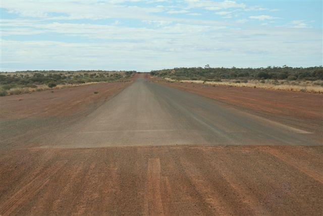
Right outside on the road we could see a windsock, and the road was bitumen for a section of about 3,000 feet (914 metres). It was a landing strip for the Royal Flying Doctor Service – and from the photographs inside the Roadhouse, other itinerant fixed wing pilots. It appears that jet fuel was even available.
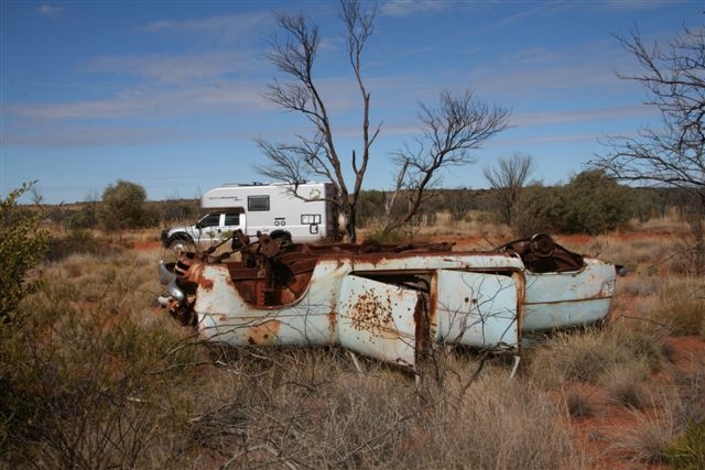
It was 68° Fahrenheit (20° Celsius) and superbly sunny as we moved further along the road. Every now and then we would see old car wrecks beside the road. They were mostly burnt out, and mostly turned upside down. We are not sure if that is where they ended up after a drunken driver rolled over a few times, or if it was because they had been pushed off the road by the local bulldozer or grader driver. Every now and then, one of Len Beadell’s famous roads would join the highway.
At 12 noon we stopped and spoke to a grader driver. This was an immaculate looking, almost new John Deere grader, being driven by Alan Humphries, who works for a contractor to the Aboriginal Shire of Warburton. Alan lives in Margaret River, to the south of Perth, and works 4 weeks on and 3 weeks off. When he is working it is for 7 days a week and 11 hours per day. Interestingly enough, we could hear some Slim Dusty music playing in the cab of the grader, and Alan told us that he had once worked as a drummer for Slim Dusty! Fantastic!
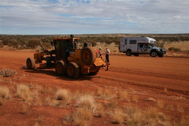
He worked for the Warburton Shire, known as the Shire of Ngaanyatjarraku. He could pronounce it but we couldn’t! Up until this point the road had been under the Shire of Wiluna. Now we were in the new Shire.
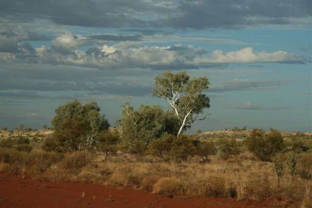
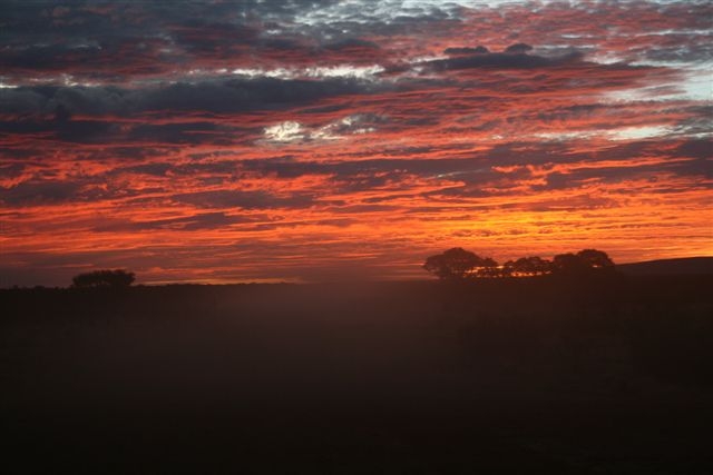
The countryside now started to move from the almost dead level “arid zone” to undulating hills, which every 10 minutes or so would give a magnificent view out over the desert oaks, Spinifex, and every now and then a red cliff in the distance. There were high cirrus clouds in the sky.
We managed to maintain about 90 kph with a tailwind. One of the best reasons to drive anticlockwise around Australia is that drivers get a tailwind when they are heading across northern Australia (from the south east trades), and normally a westerly when heading either across the centre or further to the south.
There were more car wrecks as we passed the famous Heather Highway, built by Len Beadell in the late 1950s. At 1.35 pm we stopped for some egg sandwiches. In the distance we could see an occasional sand hill and Telstra tower.
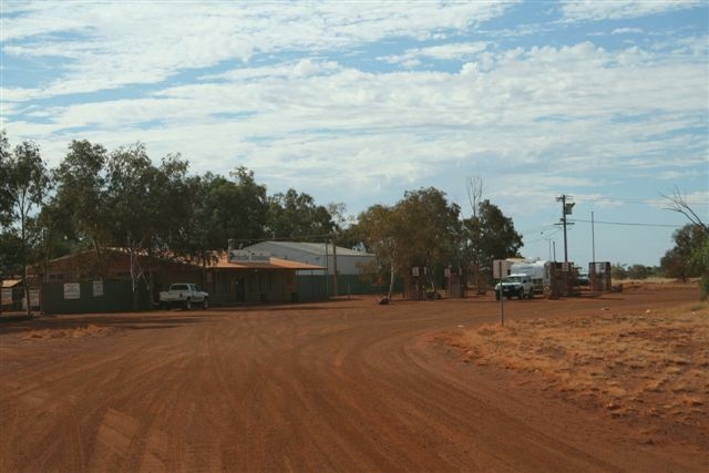
We stopped at the Warburton Roadhouse. Just before this, there was a road heading into the Warburton settlement with a large sign, in effect saying “no entry.” Outside the Roadhouse were petrol pumps with wire cages and “no photo” signs. The last time we had experienced a problem in taking a photograph was at the railway station in St Petersburg. All the way through the rest of Russia and Kazakhstan there were no restrictions on taking photographs, but here in our own country there was a problem.
The staff inside said it wasn’t actually that people couldn’t take photographs of the petrol pump, it was just that people could not photograph an Aboriginal person or of any of their sacred sites. What a pity. Pip remembered the photograph she took of Brett, the Aboriginal in Meekatharra, and how delighted he was to pose for the photo.
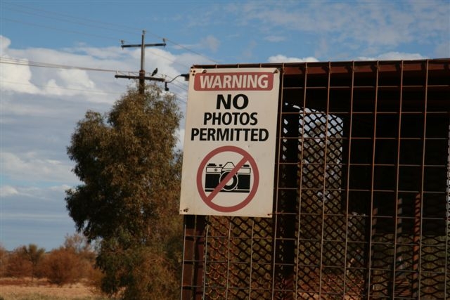
The problem in relation to sacred sites is that Google Earth covers the whole of the world and there are literally thousands of people looking at photographs of Aboriginal sacred sites every day. It is very hard to reconcile traditional beliefs with modern technology.
It is so sad that none of the Roadhouse staff were Aboriginal. One of the problems of these wonderful Aboriginal settlements in the outback is that there is often no work, and even when there is work available (such as working in a retail shop) the Aboriginal people are not the ones who perform the duties.
There was a road directly from the Roadhouse to the community, and there was no sign saying “no entry” – perhaps it had been pulled down by vandals – so we drove along it, hoping to see the airstrip, which we heard had been sealed with bitumen. We got reasonably close to the strip, but remained on a circle outside. We could see why people were not welcome in the community!
As we headed further east we found that we were following the new Telstra fibre optic cable. We wonder if it goes from Warburton right through to Ayers Rock (Yulara) and thence to Alice Springs. No doubt we will find out in the next few days.
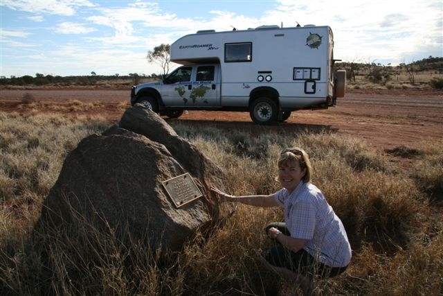
A little while later we stopped at the “Tim Ballinger Memorial Stone.” Tim was born in November 1971 and he died on 14 September 1992, however we have been unable to find out any information about him.
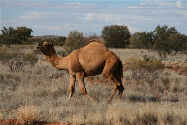
As well as old car wrecks frequently being on the side of the road, we started to see an increasing number of camels. Sometimes there were one or two, sometimes half a dozen. There are more feral camels in Australia than ever before. Feral camel numbers in Australia were estimated to be around 500,000 in 2004, with over half of that number in Western Australia.

At 5.15 pm we arrived at the Giles meteorological station. Dick loves the Bureau of Meteorology because they have given him such wonderful service – not only on the flights to Antarctica and around the world, but also on the balloon flight across Australia and from New Zealand to the Australian mainland.
We were immediately welcomed by the staff, and Gerry Clougher insisted on making us pancakes with ice cream. Delicious! They also had the latest newspapers which brought us up to date. Modern technology was there as well. Cres had phoned saying that Pip and Dick had to sign a power of attorney for the sale of some premises in Sydney, so we were able to do this in the met office with the fax machine.

We are now parked right beside the radar transmitter, and at 8.45 pm Dick watched the balloon go up and the monitoring by the radar.
There is an Aboriginal community nearby and they obviously retransmit television from the satellite. We were able to turn on our British TV (which was bought on Edgewere Road) and we received Channel 7, Channel 9, the ABC, and SBS in perfect colour and quality. Such is being in the outback!
Possibly tomorrow we will be at Ayers Rock, and we will even be in telephone coverage.
Total today 621 kms 35,976 kms since Anchorage, Alaska.
Click here for the next day.
Click here to return to the Smith’s Overland main index page.