17. Day 12 – Exploring more of Yellowstone National Park
Saturday 20 May 2006
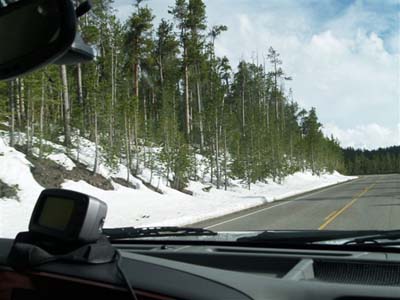
After a good breakfast we departed at 9.30am in light rain at 53 degrees F. We stopped at the Visitors Centre just above the campground and noted that the Loop Road between Tower – Roosevelt and Canyon Village was still closed due to snow. This is the highest road in the Park with Dunraven Pass at 8,859ft. After half an hour in the visitors centre looking at the historical displays we back tracked to the south via Norris to Canyon Village. Shortly after leaving, brilliant sunshine appeared – such is weather in alpine areas.
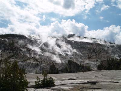
We stopped at the Roaring Mountain – undoubtedly one of the most scenic fumaroles areas in the Park. Unfortunately our photographs, because of the angle of the sun, cannot do justice to this extraordinary area.
Roaring mountain
We drove slowly – the maximum speed limit in the Park is 45mph anyway.
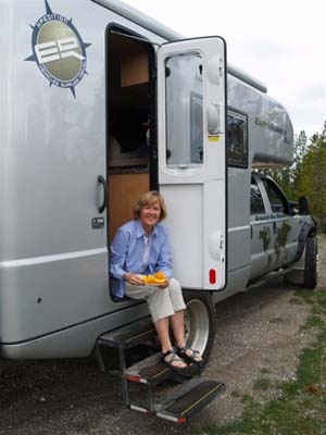
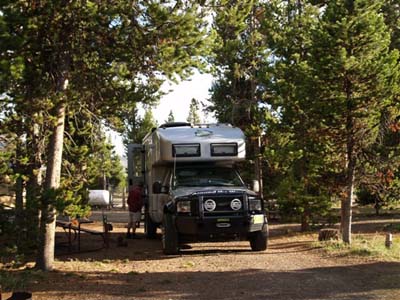
We stopped beside the road for a quick snack
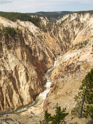
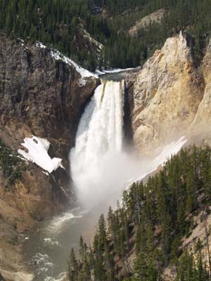
Arriving at Canyon Village we drove straight ahead at the junction to Inspiration Point. Yellowstone Canyon, formed by the Yellowstone River is on par with the best scenery anywhere in the world.
Looking towards Lower Falls and the Yellowstone RiverYellowstone River in the other direction from Inspiration Point
As we looked from Inspiration Point towards the lower falls we could see tiny human beings standing right at the brink of the drop off.
Lower Falls from Inspiration Point
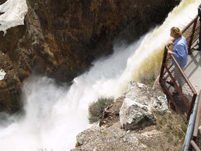
We decided that we should walk there. This is a track that drops from Lookout Point. We dropped the 600 feet to a concrete platform on the brink of the falls and on the brink it literally is.
Standing on the brink of the Lower Falls
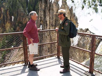
Dick spoke to the local Park Ranger about whether such a lookout could be located in a similar area in modern times.
Dick talking the local Park Ranger
The Ranger said he believed it would be as the Park was very orientated to allowing human beings to get close to the points of interest.
On the 600ft climb back out to the Earthroamer we noticed the effect of altitude as we were still over 7,500ft – that is higher than Mt Kosciusko
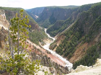
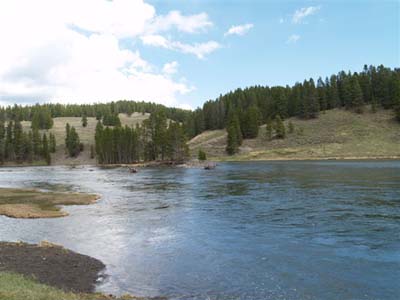
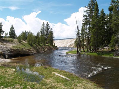
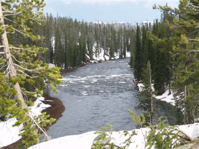
We drove further southeast along the road, which follows the Yellowstone River, with once again, need we say it, magnificent scenery of the rushing river and the lodgepole pines – not actually burnt in this area. We stopped in the trees at the Nezperce Ford for lunch.
Yellowstone River where we stopped for lunch
We sat beside the Yellowstone River but a cold breeze came up so we didn’t stay long.
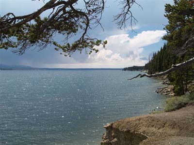
Further south we passed Yellowstone Lake, which has a maximum depth of 430 feet and has an elevation of 7,700 feet.
Yellowstone Lake
From the empty mariners beside the road it is obvious that this is a haven for trailer boat enthusiasts when the weather is warmer.
At West Thumb we turned west and crossed the Continental Divide not once but twice in less than 20 kilometres. The highest pass was 8,300ft.
Crossing the Continental Divide
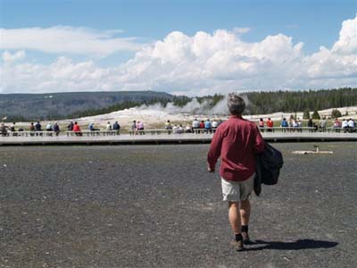
By then we were in beautiful sun at 64 degrees F as we arrived at the Old Faithful car park. We walked over to the seating area where already 200 people had assembled.
Dick walking to the viewing seats at Old Faithful
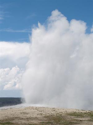
One of the tourists told us that the Rangers had predicted that it would be 20 minutes before the next eruption. By the time the eruption had occurred about 40 minutes later there were about 2 thousand people watching. Old Faithful is not as high (about 80ft) or as spectacular as some of the other geysers in the Park but it is the most regular performer. That is why it was named Old Faithful by the first white explorers to the area.
Old Faithful erupting
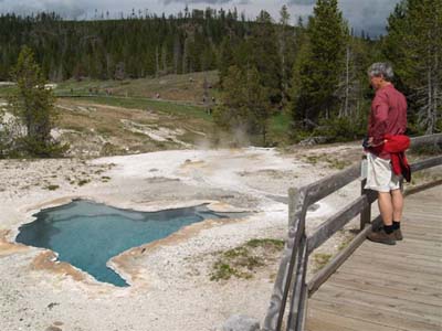
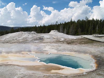
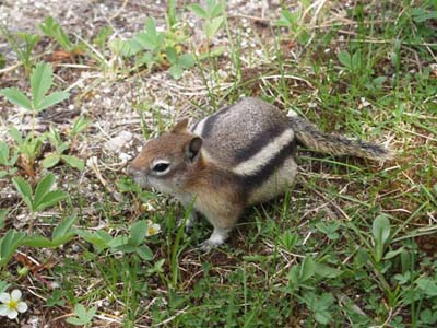
We spent the next 2 hours walking the boardwalks in the area.
Dick standing on the boardwalk that takes tourists all over the area of the geysersA beautiful stream running through the treesGeysers near Old FaithfulCastle Geyser eruptingA little chipmunk we found running around one of the boardwalks
The National Parks have done an excellent job in maintaining a balance between the vast numbers of people who want to have a close encounter and preserving the environment. Everything is spotless in Yellowstone, there is not even a piece of paper or a plastic bag lying on a road verge and in the whole 3 days in Yellowstone we only saw one road kill, to our inexperienced eyes it looked to be a marmot.
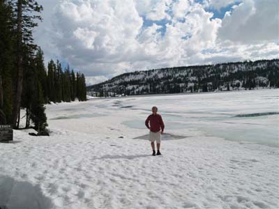
We asked at the Visitors Centre if there was a place where we could stay the night between Old Faithful and the Southern Entrance of the Park, we were told no, as the camping areas were generally not open until Memorial Day (last weekend in May). We decided to drive back along the road to West Thumb and then out through the South Entrance. At Lewis Lake we were surprised to find it still frozen solid.
Dick standing on frozen Lewis Lake
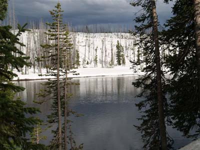
The highway follows the Lewis River which heads south (the opposite direction to the Yellowstone River) to eventually end up in the Pacific Ocean. The bushfire damage from the 1988 fire is very apparent in this area and we couldn’t quite work out why there was so much more snow on the ground.
Snow on the hillside that was badly burnt in 1988
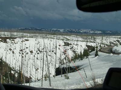
All along the way we stopped to take photographs and enjoy the scenery.
Beautiful scenery as we drive towards the South Entrance GatesLewis River
We passed through the South Entrance of the Park at 6.30pm but from the angle of the sun there was at least another 3 hours of daylight. We were tired so 15 minutes later we pulled off the road into the Flagg Ranch campsite and stayed the night.